
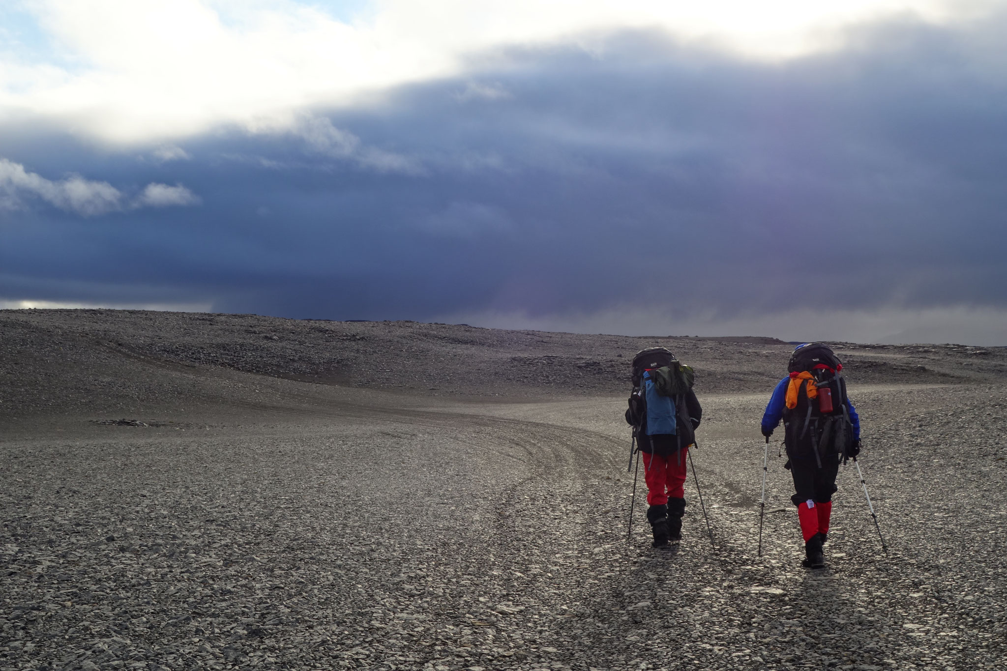
21st November
Turbine-Tacheles
Finally we get to one of our core topics of our crossing: the energy supply of our electrical devices.
Our goal was to manage all the charging with the small portable turbines we had been checking out for quite some time by now: the Waterlily and the Enomad. However our various tests with the two devices have been showing that the whole charging process would not be as easy as we had imagined. Finding optimal waters for the turbines was quite difficult and the electrical output was lower than expected. However, these two were the most promising units we could find and so we didn't want to give up on them so easily.
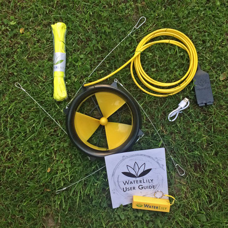
Waterlily:
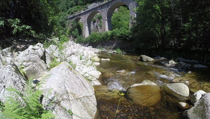
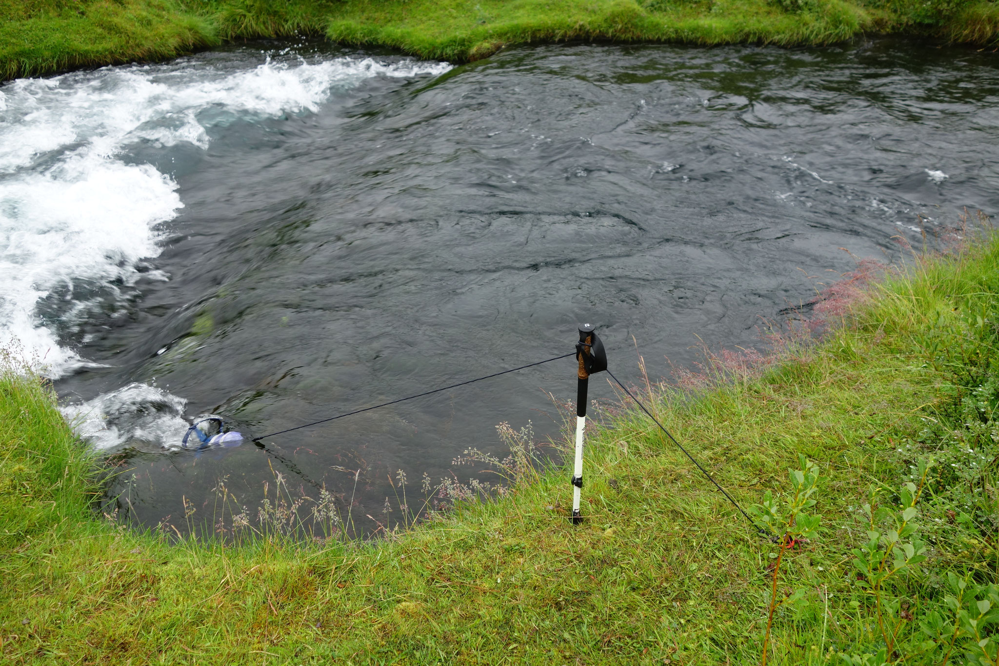
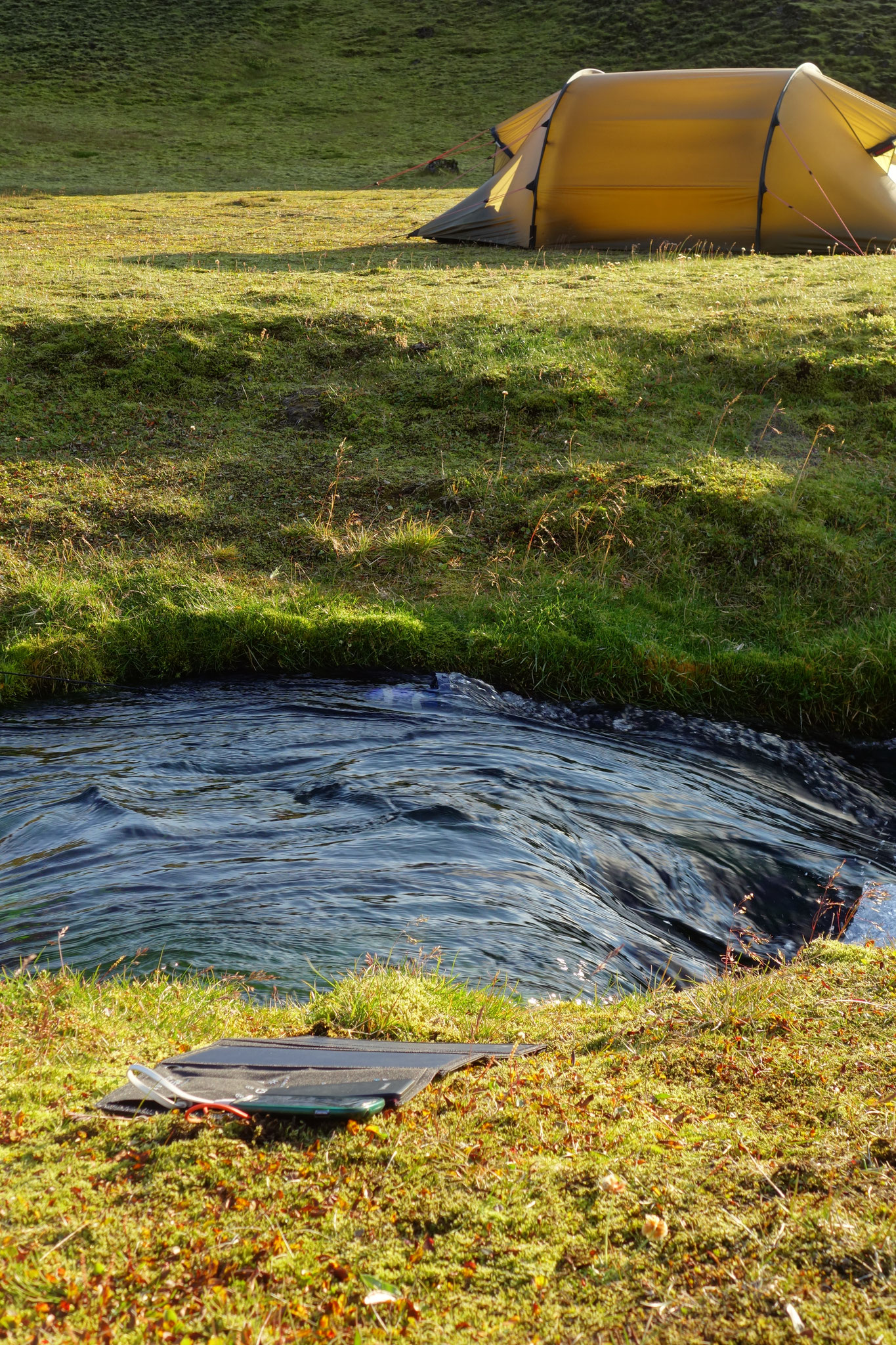
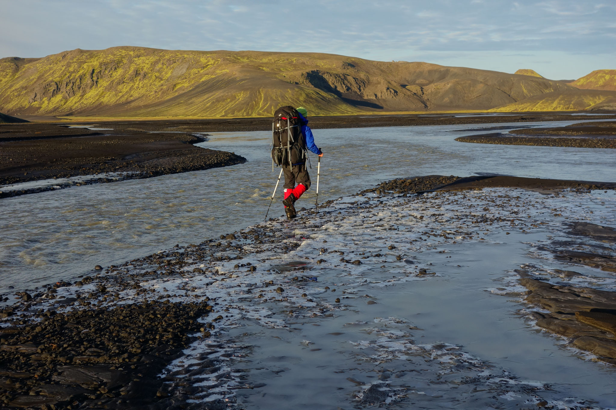
The turbine, which was supposed to generate electricity from wind and water, turned out a little heavy with its 1.3 kg for our purposes of crossing Iceland, where we had to cut every gram. Additionally we quickly realized that for a few watts, significant flow velocities were needed to get a power output at all. Coupled with the large cross-sectional area of the rotor, an enormous volume flow through the turbine is necessary which a small stream cannot provide. In contrast, in large rivers that can offer both, you would have to go into dangerous currents for placement and suspension. Especially when you have to use the river rocks upstream to fix the turbine. In glacial rivers you hardly want to take the risk, not at last because of the unintentional cooling you get everytime. In our tests with the Waterlily we got the ‘best results’ in the river ‘Murg’. While being left in the current overnight it charged about 1000mAh in 10 hours into a power bank, which is enough to fill up half of a typical smartphone battery.
For electricity production from wind the Waterlily seems to be unsuitable. Since there was no windy opportunity to simulate Icelandic conditions on our test tours, we have set up the Waterlily in the wind tunnel of our university under optimal conditions. Unfortunately, the electrical power output was close to zero.
Enomad:
The weaknesses of the Waterlily are the strengths of the Enomad... and vice versa. A weight of 700g, the smaller, handier pack size and the integrated battery make the Enomad attractive compared to the Waterlily. The Enomad requires (and tolerates) lower flow velocities but produces almost the same as the Waterlily.
As we wanted to get the most out of the Enomad, we exposed it to faster flows, which were obviously to strong and broke a gear in the mechanics. So the Enomad is less robust and more vulnerable to damage than the Waterlily, which didn't break - even in the fastest rivers.
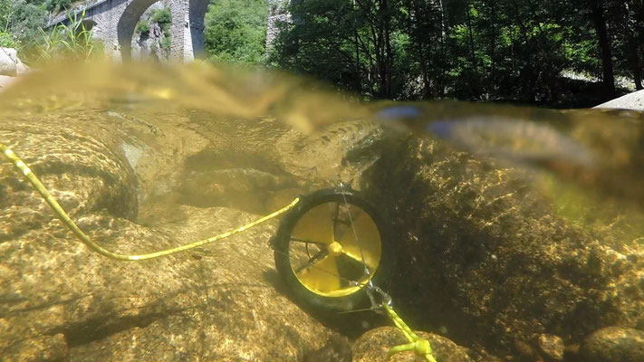
After a manual repair of the Enomad we tested both turbines in the same night in the river Murg. The Enomad was exposed to slightly slower water than the Waterlily. Both performed in 10 hours approximately the same: 1000mAh (see following pictures).
Based upon our test experience, we decided to take only the Enomad with us to Iceland. Not as robust but less weight, smaller pack size and about the same performance. Concerning the battery we were worried that it might charge even less in the low temperatures of 0-2°C of the glacial rivers?! The company Enomad was very cooperative when they heard about our broken Enomad and sent us a second revised device. The new and improved Enomad arrived just shortly before our departure to Iceland. Unfortunately - without any time for a single test - we just packed it and flew to Iceland... Shame on us, you should never take devices you never tested before on a trip like this. But sadly we did!
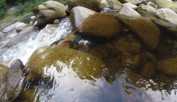
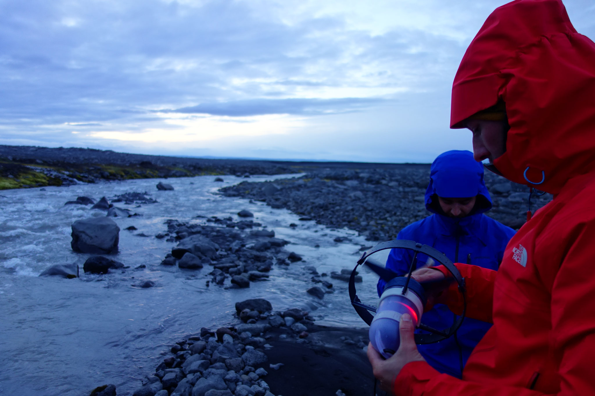
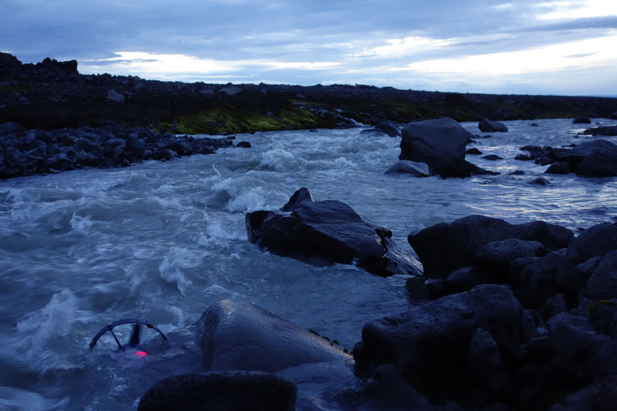
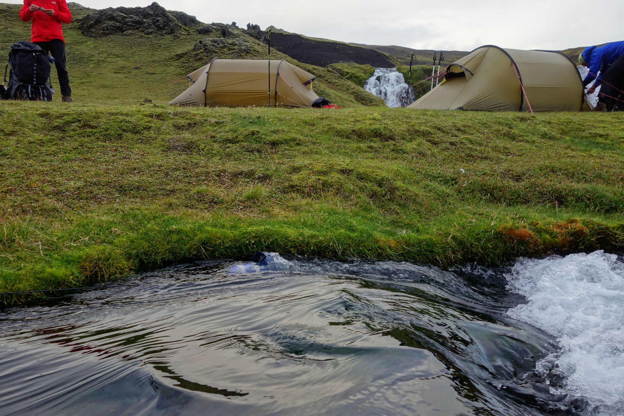
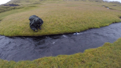
As expected we only found few suitable rivers during the crossing. Most of the streams were too small to submerge the Enomad completely. Only three rivers had clear and fast water, well suited and looking promising.
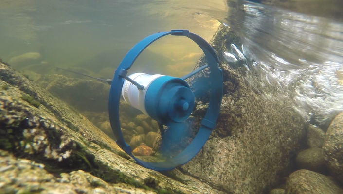
However in the first occasion we used the Enomad, we had to pay the price for taking an untested device with us: the new Enomad seemed to have a technical problem. The irregularly flashing of the battery gave us feedback that something was wrong. Something like a loose contact maybe, but we couldn't find out, what it was. It was as if the optimal water speed range was indicated by flashing, which was seemingly impossible to maintain. Since we didn't know exactly whether the battery would charge anyway, we unsuccessfully and frustratingly tried several times.
Additionally in the larger glacial rivers - mostly ice-cold, murky and sediment rich - the Enomad couldn’t cope with the sand transported in the water. After around 30 min the sand had blocked the propeller. It seems that the Enomad is unsuitable for such waters, probably like other turbines.
Below are a few pictures of the Enomad in operation on Iceland:


Conclusion:
Unfortunately the technical problems of the Enomad made it unusable. On the other hand, the sand would probably have blocked the more robust Waterlily as well. In the three clear rivers a functioning Enomad could certainly have generated electricity.
Given the facts we were happy to have a photovoltaic (PV) cell as a backup power source with us which was really reliable. On sunny mornings it charged our batteries while we had breakfast and packed our stuff together. Even some sunny lunch breaks were stretched a little due to the charging. That wasn't bad at all, but a working turbine would have charged the devices overnight. When the sun was shining the PV cell (weight comparable to that of the Enomad) easily produced 10W.
Despite our unfortunate experiences, we are still enthusiastic about the idea that we will be able to rely on waterpower on tours like this in the future. We think that a little more development (Waterlily has a 12V version by now, which looks a little more promising) is needed to make these small water power plants more robust and efficient. We would like to thank Waterlily and Enomad for providing their turbines to us. Both of them were very cooperative and motivated to support our trip. We will continue to follow the development of the two turbines in the future. And let's see, maybe in a couple of years a team will manage to solely run their devices on wind or water generated electricity. We would definitely be impressed!
Your Mission Iceland Crew
#missioniceland #4sam8sam1sam
28th October
The slightly different route assessment
Saelir vinir!
It's about time that we let you hear from us again.
We have all arrived back home in Germany and made it back into our everyday life as students in Karlsruhe successfully ;)
Nevertheless we don't want to miss out on the blog, as we are busy screening our material. Therefore, this post will be about the route, which we just evaluated.
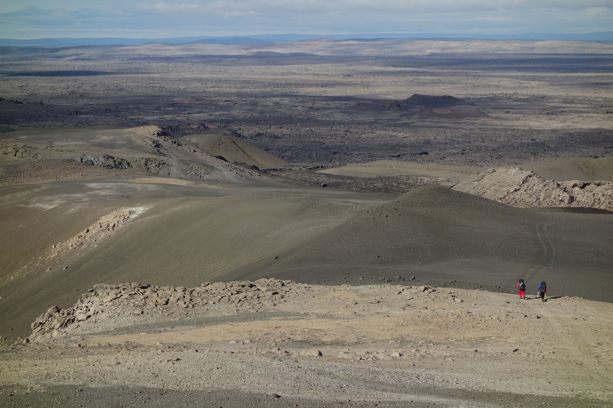
It was 579 km long - from the northernmost point Rifstangi to the southernmost point Kötlutangi. If you now include the distance from the paved road to the northernmost and southernmost point (as we had to walk this way twice), you get a total length of 589 km! This is pretty much the walking distance from Karlsruhe to Berlin! Unfortunately, we missed the 600 km mark only by 11 km, but much more important is, that we managed to finish the tour ;)
In general it worked really well with the orientation by map and compass. Only a few times (especially in the north) small paths seemed to be wrong on the map, but luckily that didn't bring us in any bigger trouble.

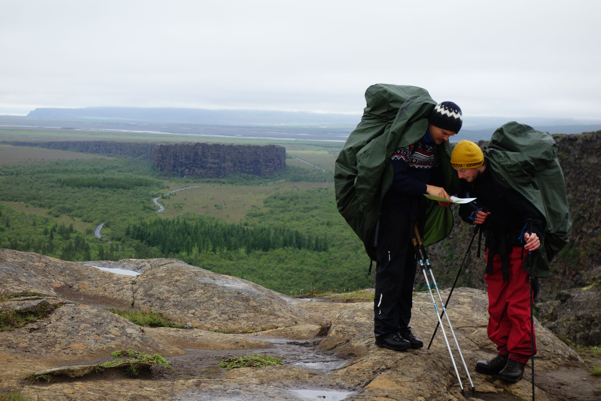


The pre-planned route of the crossing with 540 km, was also pretty much fulfilled. With 579 km the total route was only 40 km longer. Taking into account that on such tours, you always walk more than expected, this was totally acceptable. We even walked about 30% or 180 km off-road. Off-road means that we navigated freely through the no-where without being able to orientate ourselves on gravel roads or hiking trails.
And that wasn't always as easy as you would think. Once we even missed our targeted point by about 2 km! "Unbelievable, how could that happen?"
We had always used the compass very carefully. Maybe the Icelandic trolls were playing tricks on us or were the maps just wrong or were we simply too stupid to navigate?
That same day during the tour the issue of the magnetic declination (the deviation between magnetic and geographic North Pole) came up. Could this be the explanation that we had gone so wrong? Back then we considered the influence to be rather neglectable and blamed our poor handling of the compass for the deviation. But an exact investigation of the walked route showed that we actually navigated very precisely!
The recent magnetic declination in that location in Iceland values an incredible 11.35°W, which means an error of 1.8 km when navigating a straight route of 9 km via compass. In Iceland you miss your destination by approx. 1 km per 5 km walking (assuming you don't always re-determine your position or coordinates). Crazy! We really wouldn't have expected that ;)
Of course we also checked some other places for comparison: In Germany and Central Europe the deviation is about 2°, which means almost negligible. If, on the other hand, you go on explorations in North Greenland, the magnetic declination can be up to 50°! One therefore fails completely, when just following the compass needle up there. Crazy!
But now back to our route again. We have collected some interesting facts about it:
- 135 h of pure hiking (average hiking speed of 4.4 km/h)
- Approx. 6000-6500 meters of hiked altitude difference
- 9 soft sleeping spots mostly on grass
- 18 hard sleeping spots mostly on lava stone
- 13 nights with direct access to water (river/stream/lake)
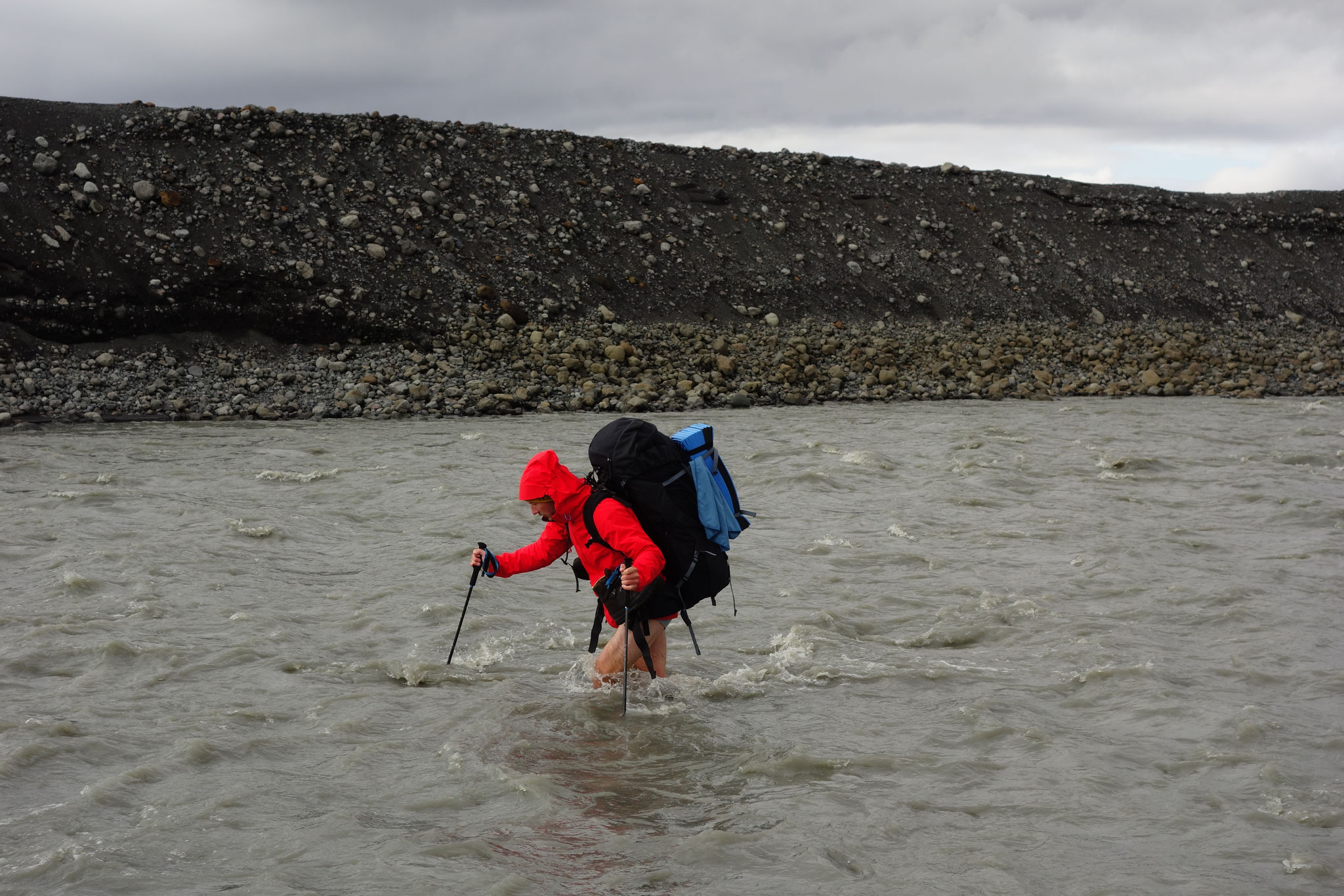
- 8 large river crossings
- We met 2 other Iceland-Highlandcrossers by foot (they did a different shorter crossing route)
- 17 out of 27 days were rainfall days
- 2.1 kg of creams (peanut butter, hazelnut, almond, macadamia, cashew cream and honey) were carried per person instead of the initially estimated 14.3 kg peanut butter.
But if you want to explore our route more closely, just have a look here on outdooractive.
We are currently busy writing a detailed route and trip article. So look forward to more Mission Iceland stories in the following posts.
But until then you should take your compass and head north - let's see where you end up ;)
Your Mission Iceland Crew


#4sam8sam1sam #missioniceland #crossingIceland
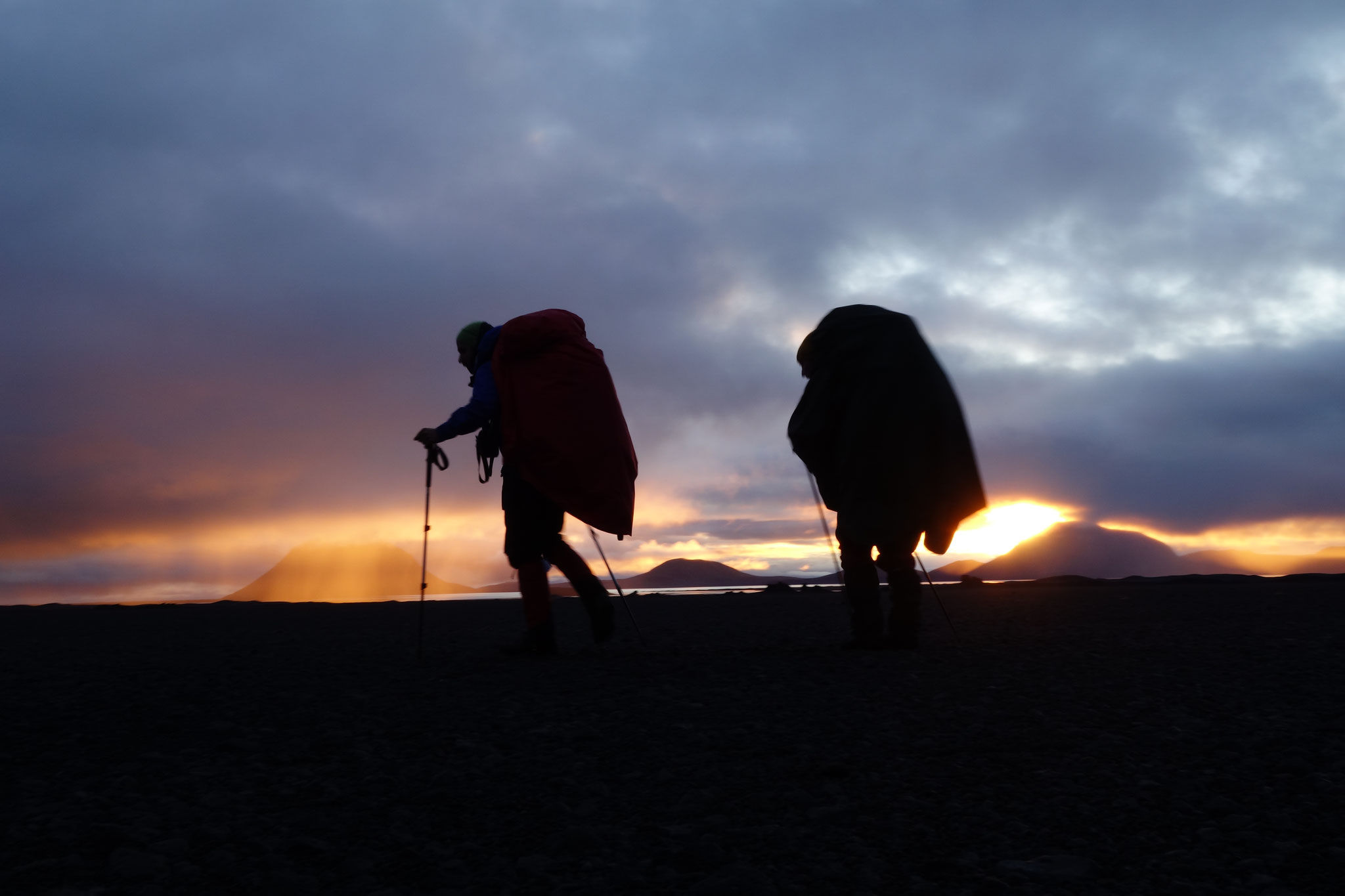
7th September
We've made it!
Dear friends, we’ve made it!! After 27 days, 591 kilometres of walking, 8 big river crossings, a total of 21kg body weight loss and 174 collected stones we crossed Iceland from the most northern
to the most southern point unsupported with renewable energies. The mission is completed and we are really happy and proud!
Unfortunately we have to tell you that Julian had to quit the trip on day 8 - his knee was causing too much problems, so that it was not possible for him to finish the tour. He is already in
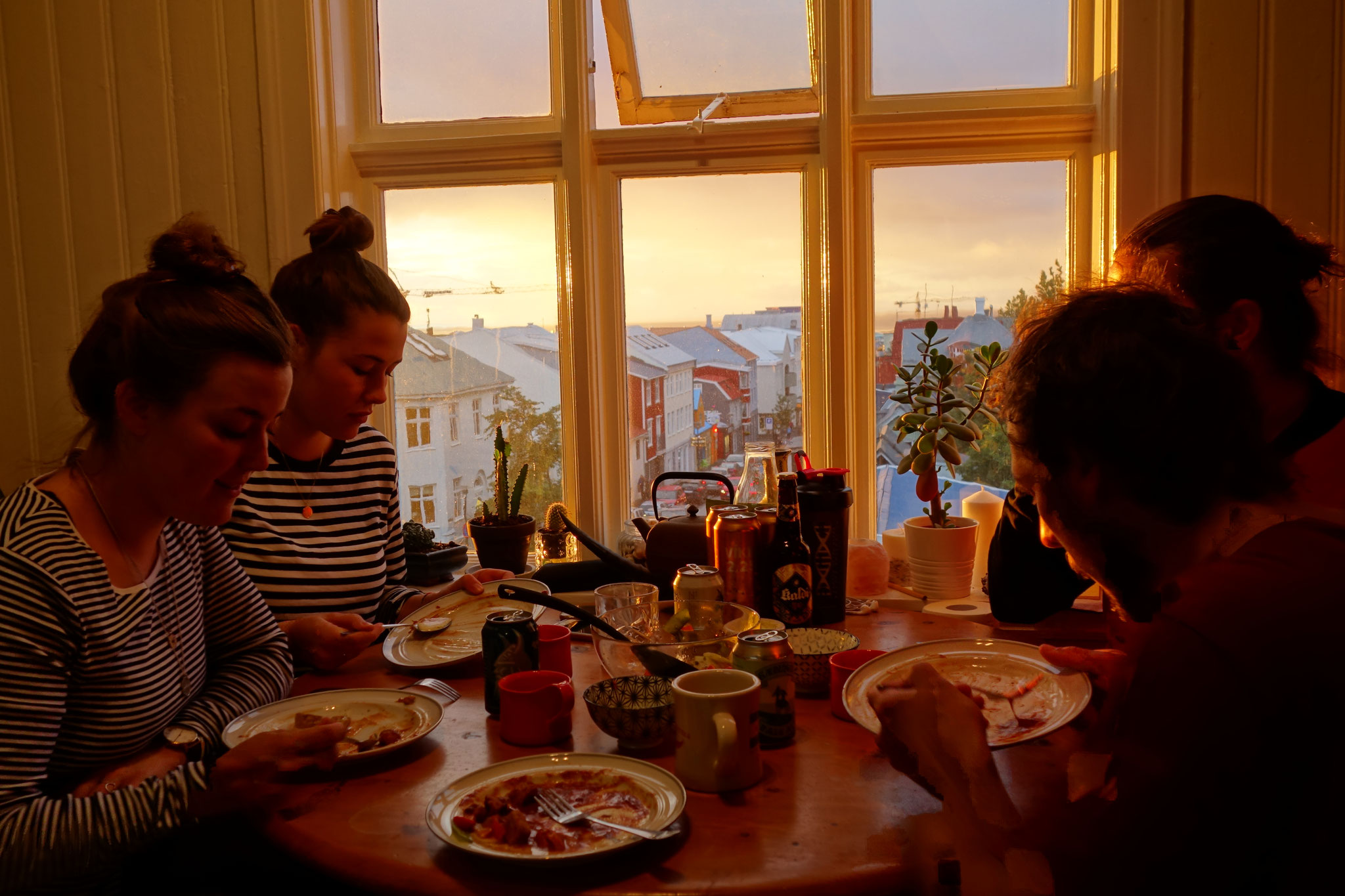
Germany and is on the process of recovery. André, Wendelin and Jens were the last days back in the apartment of Matthew (Jens's friend) - our "basecamp" in Reykjavik. On this way a huge thanks to
Matthew for his hospitality and him being such a great host to us!
After having finished our tour in 27 days on Saturday, August 31st, we went back to our basecamp in Reykjavík, where we could rest a little, collect our thoughts and understand our tour a bit
more. After so many wonderful visual impressions, special encounters with other people, strong moments of gratitude and fulfilment and really good experiences that strengthened us as a team, we
needed these days of rest!
All 4 team members lost a lot of weight during the 27 days. André was our leader with 9.5kg, followed by Jens with 5.5kg and finally Wendelin with about 4kg. Even Julian lost 2kg in the 8 days he
walked with us. It is remarkable how different our bodies managed the amount of available food. Those of us who had slightly less fat reserves in the first place lost only about half as much
weight as the others. Their bodies seemed to digest more efficiently.
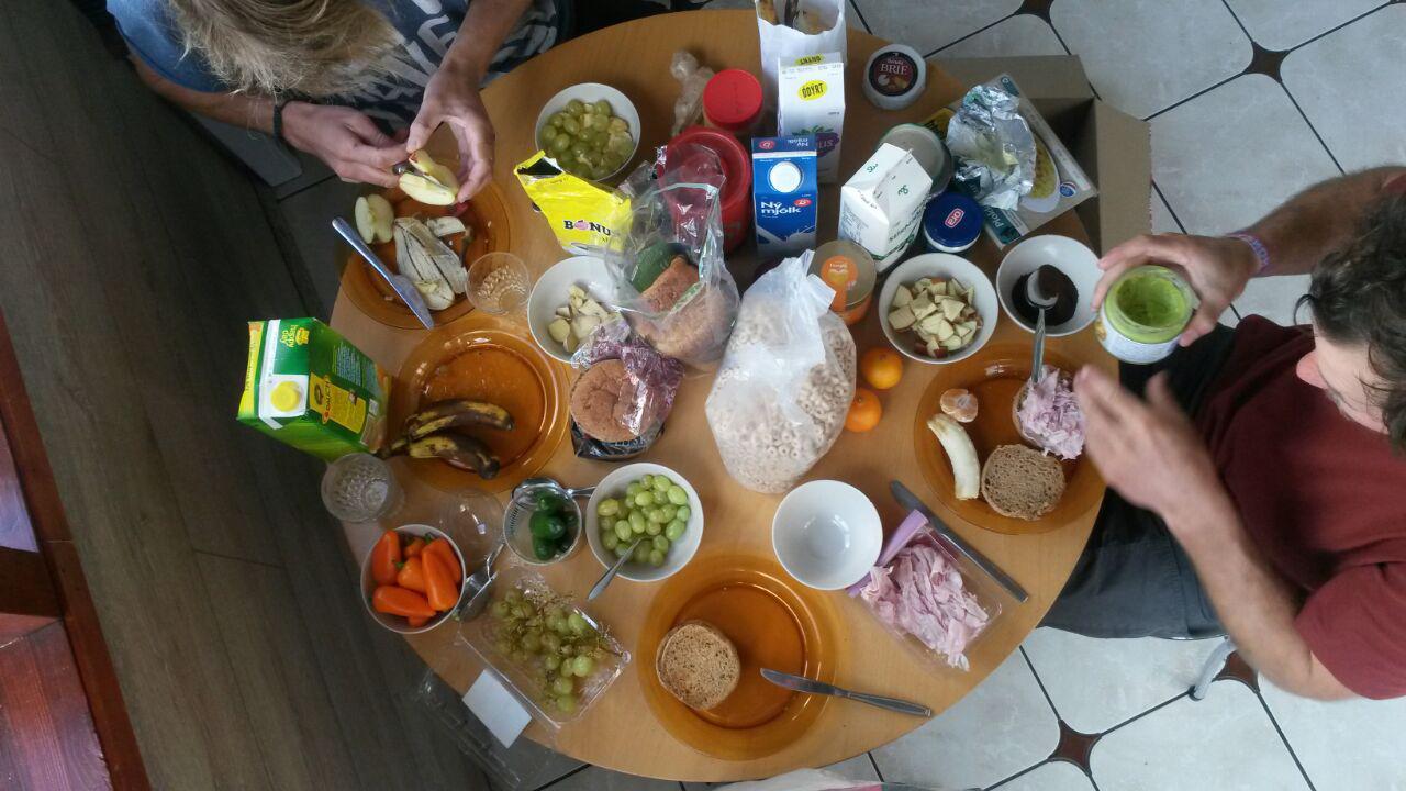
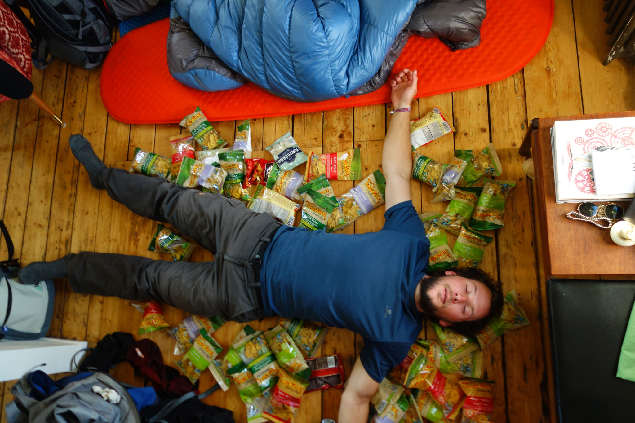
That's why we obviously used the first days after our trip to eat well and a lot again. Of course we could hardly control ourselves when it came to quantity, so that we really knocked ourselves
out. Coming back in great physical shape from our 27-days hike - thanks to our carefully planned diet and the high quality of our food - we apparently didn't miss anything on the way - the
changeover to a normal diet was longer and more difficult than expected. We made the mistake of changing from our many small portions during the hike to two huge, extensive meals a day, which of
course overloaded the stomach and was not particularly clever. It took about 3-4 days until our digestion had adapted to our new eating habits and also to the new type of food. New type of food
because we took advantage of the well accessible and well chilled Icelandic dumpsters, which provided us with lots of dairy products, all kinds of pastries, many ripe fruits and even frozen meat,
which had been dumped minutes before. Also high quality chips in masses: vegan, gluten-free kettle-cooked banana chips were rescued by us.
On Wednesday we finally left our basecamp at Matthew's and settled in a guesthouse for three nights to relieve him a bit and let him have his apartment for himself again. Tomorrow - on Saturday -
we will slowly head east to Seyðisfjörður, from where Jens and André will take the ferry to Denmark on Wednesday, September 12th. Wendelin will stay another week longer and fly back to Germany by
plane on September 18th.
In the next weeks we will share more of our impressions with you and tell you more detailed about our trip. But first of all we need time for ourselves and time to view and sort out the tons of
material we produced on the trip.
The next update will be sent from Germany.
Until then all the best from Iceland and it can be said: We enjoyed every single moment of our very special trip!


#4sam8sam1sam #missioniceland #rechargeinreykjavik # backtosociety
2nd August
What we gonna eat?!
"If we want to eat 3,000 kilocalories a day and we're out for 30 days... then everyone needs 14.3kg of peanut butter!"
That's how all the food planning started. Take the most energy-dense food you can find, and preferably a lot of it!
Since we started with this concept some time has passed and the rationing concept has been completely revised. What concerned us about this concept from the very beginning was less the thought that the motivation to eat the same thing over and over again could spoil our mood at some point, but rather that we wouldn’t survive such a diet without constipation.
Well, it really doesn't have to be just peanut butter, but being fully supplied for a whole month with only 14.3kg of food is quite a high goal!
It should be mentioned that proteins and sugar each have a calorific value of 400kcal/100g, fat is 900kcal/100g. Depending on the composition, foods with a low water and fibre content can achieve a maximum calorific value of 400-900kcal/100g. The calorific value of natural food is much lower, whereas nuts with their naturally high fat content and low water content form the upper limit. Roasted macadamia nuts with an energy content of 750kcal/100g are amongst the best, whereas dried fruits hardly reach 350kcal/100g despite the reduced water content. Even grain averages 350kcal/100g. In this blog we would like to give you an overview of what we want to eat on the trip.
Breakfast
Anyone who would like to do a hike lasting several days would say: “For breakfast? Gaanz klaar Muesli!” and that's what we would say! We got a little inspired by a certain 'Seamus', who commented his recipe for the 'Supermüsli' under the packing list of Alastair Humphreys' ‘Expedition kit list for Iceland'. Thank you Seamus! A very good recipe, which we also tried out that way. However, we adapted it, did some fine-tuning and made it even more energy-dense by adding more coconut and even better nuts (macadamias, Brazil nuts and pecans). Now it values 500kcal/100g instead of 470kcal/100g. The new recipe is called: ‘Supramüsli’! ;-) That’s 1000kcal for breakfast, meaning one third of our daily portion! Particularly exact people would maybe call our Supramüsli ‘nut flour with 1 dried fruit’, simply because the oats portion was drastically reduced, not seeing the inner nut potential. :-E
Snacks
“If you get a good cereal in the morning and a hot dinner in the evening, then peanut butter should do during the day” ;-)
... But again the desire for variety, colour and balance largely replaced peanut butter. However, after the first test tour in the Vosges, a 350g can of ‘peanut butter types’ for four people a day was found to be important and necessary. Licked from the spoon or as a dip to whatever... if you're hungry, peanut butter won’t let you down!
Because trail mixes belong on every trip and because hard cheese keeps well and tastes good - even without bread - trail mixes and hard cheese are also included! Of course our best friend the chocolate is also part of the trip. It is the equivalent to what a really fat maggot would do to Bear Grylls: “keeping the morale up”!
Thus our daily snacks consist of 87.5g peanut butter, 50g salami (or dried fish, the Icelandic alternative), 50g trail mix, 50g hard cheese, 25g chocolate and 50g muesli bars totalling 1500kcal.
Dinner
From experience we can say that one warm meal in the evening is essential. Especially if you've been hiking through the rain and cold all day! That's why the proven couscous and the Asian classic of lazy gourmets finally comes into play here: ramen. That is one pack of ramen noodles of 65g with about 55g couscous in 0.5l boiling water. Bring the water to the boil, put everything in and let it sit for a while. Easy, fast to prepare and saves fuel. Instead of couscous we will also use wheat, spelt or corn semolina. This brings variety, but does not change anything volumetrically or energetically.
As an alternative there's mashed potatoes. Refinement is possible by adding milk powder, freeze-dried vegetables or cheese (which everyone has to save from the daily ration).
That makes about 120g at 500kcal for dinner. It doesn't sound like much, but it stuffs well.
Now you might ask yourself: "Why don't they just take these tracking meals with them: freeze-dried pasta with goulash powder and an extra portion of glutamate for example! It's so light and calorific-terrific" That may be true, but we didn't want to pay €5 per meal if we could put it all together ourselves. And we don't really know any enthusiastic supporter of these ready meals...
So all in all, our daily provisions consist of 200g muesli, 312.5g snacks and 120g dinner - a total of about 650g including packaging, which would result in 19.5kg of food per person for 30 days. But we thought that this was too much for the start. Therefore we have shortened our rations by 5 days in accordance with the route planning. The entire route should take about 25 days. For delays due to ‘bad weather’ or rest we consider 5 additional days, for which everyone on their own has to put back a müsli bar and occasionally some muesli.
This results in 16.5kg of food per person. So 4.6kg additional weight to the much less varied and package-free calculated peanut butter variant from the beginning of this blog (calculated down to 25 days), which would have led us into a peanut butter crisis sooner or later for sure! For particularly tough days we have 200ml linseed oil with us as an additional energy reserve, of which you can add something to your meal. We should get away with this, but we cannot prevent each of us from losing a few kilos!
So just remember:
Eat funk, become soul.
It’s nuts, and it’s not.
And above all: Nuts or not, that’s the question. :-D


#4sam8sam1sam #powerfood #missioniceland #supramuesli
28th July
#4sam8sam1sam
In 4 days we are finally heading to Iceland, but before that, we have to tell you about our hashtag! (Yes! Believe it or not, we have that too;)). #4sam8sam1sam simply is the name. Maybe some of you have already spotted #4sam8sam1sam on Facebook or on Google.
So what is #4sam8sam1sam all about?
Sadly, that is not that easy explained in english, as #4sam8sam1sam is based on german. But we will try to explain it to you! Let's start with the first ‘-sam’ - 4sam or foursome: We have derived this term from the word ‘twosome’ or if you like even ‘threesome’. This way ‘foursome’ is supposed to embody our team component. Our goal is to achieve this mission as a team of four. The team idea comes first. In each of our weekly planning meetings we are confronted with that! Every planning discussion is preceded with an extensive, cheerful team meal ceremony, in Germany we call that ‘Brotzeit’ ;) Chocolate is always ending this ceremony. But that someone would eat the whole chocolate bar alone is an absolute No-Go ;)
‘8sam’: The German word ‘achtsam’ means something like careful in the sense of mindful or attentive while ‘acht’ beeing spelled and pronounced the same way as the number 8. We want to be mindful and attentive in three different ways. Attentive in dealing with each other in a team, attentive in dealing with one's own body and mind and also attentive in dealing with nature and our environment. Mindfulness or attentiveness is therefore important for us in several dimensions. Leaving any garbage in the highlands (except our bowel movements of course;)) is out of question for us. Iceland's nature is a highly fragile ecosystem and should be treated with care.
Within this matter we would like to mention our supporter nucao*, whose chocolate bars are packed in biodegradable plastic (cellulose foil). And this is exactly the direction, the trend for all plastic packaging has to go, if not completely avoidable.
We also want to lose some words on sustainable travel. All four of us are big fans of travelling and discovering other countries and cultures. At the same time, sustainability and environmentally conscious lifestyles are very important to us. But this naturally leads to a dilemma! Flying would be a No-Go. However, we do not want to restrict our urge to explore that radically, but we try to leave the lowest possible CO2 footprint. That means we prefer the train, the bus or the thumb (hitchhiking) to get around. Sadly, it is very difficult to hitchhike or swim across the Atlantic to get to Iceland. All we have left are the CO2-intensive possibilities - airplane and ship. However, the CO2 emissions can be offset by supporting environmental projects such as reforestation or the promotion of renewable energies. In that way our CO2 emissions are compensated somewhere else. Some voices might now say, that this is just getting rid of your responsibility! But in fact, this is still better than doing nothing at all. Exactly here the myclimate* fund comes into the game, as they are taking care of our CO2-compensation by funding sustainable eco-friendly projects. At this point, many thanks to myclimate!*
But back to #4sam8sam1sam. The last ‘-sam’ is 1sam or onesome: This means basically ‘lonesome’ in english. On most of the route we will be all on our own. Next to the four of us and our backpacks we find only stones, lots of stones! Well, at the beginning and the end also a bit of green and some waterfalls, but apart from that, the landscape in the highlands will be rather monotonous and remind us of big emptiness. We will probably not meet other people for several days.
That’s it for the individual ‘-sam’s. I hope you got the idea a little bit ;)
Maybe you will even think of us the next time you hear ‘-sam’ and maybe there are even more ‘-sam’s or ‘-some’s which we have not even considered. If so, let us know! :P
In this sense: Remain mindful (8sam) and not lonely (1sam), but better 4sam instead!
Rafmögnum auðnina!
* Nucao provides us with some of their chocolate bars free of charge and myclimate compensates our travels from Germany to Iceland. However, these mentions were not connected with the fact that we actively advertise the products and services, as happened in this post. The promotion of them in this post was made completely voluntarily and out of our personal belief in this product and not because we have committed Myclimate and Nucao to place their products accordingly. Click here to read further on our supporters.

#4sam8sam1sam
10th July
The 'Enomad Uno' Turbine
It was some weeks ago that the Korean company Enomad contacted us again. They have an interesting turbine we found during our first research, so you might have heard the name before. The decision we made months ago was very difficult and we decided on the WaterLily as it can also convert wind energy to electric energy. One difference is that the Enomad can only convert water, but has a built-in powerband. When Enomad then contacted us, they really wanted us to test their turbine as well. It is a pleasure and honor for us to test the EnomadUno turbine now.
We already had the turbine for 2 weeks now. The small box left lots of space for speculations, but the 650g water generator looked quite thought-through with its cover that protects the rotor blades when it’s packed, but makes the 5600mAh powerbank waterproof when in operation. Also… wait for it… it has a built in LED light!
We already made some tests. Maybe you are checking our page frequently, where we already posted a first video. However we were a bit too excited maybe and just wanted to have a first check. That is why in this video we didn’t attach the Enomad correctly and lost a lot of energy through rotation of the turbine itself. The result was as expected pretty much nothing but an empty powerbank.
Well this was the first test, but not the last one. Last week we had several tests at rivers around Karlsruhe, like the Alb and the Rhein. This time we attached it properly. Right below we have a video from the test at the Rhein. Unfortunately the battery did not charge as well due to lower water speed. Watch and enjoy! ;)
We are looking forward to more tests and to good results. Keeping you updated!
Rafmögnum auðnina!
#4sam8sam1sam #rafmögnumauðnina #missioniceland #enomad
1st July
Mission Iceland from head to toe with FMEA coach Lukas
Our tour planning is running at full speed at the moment! But are we also planning on the right track, so that we are reaching the southernmost point of Iceland safe and sound?
As you all know, we are super motivated students (or at least pretend to be ;))! In university we get to know a lot of
theory! But sadly, all these theories are rarely applied in practical real use cases. That is the reason why we thought, we should check and investigate our Mission Iceland with one of these
theories to see if we really considered everything in the planning.
One afternoon, we sat at the campus with a high quality AKK coffee (for the non-Karlsruhe people: AKK is the legendary social hub of the KIT campus) talking to our friend Lukas. We figured out,
that he actually is quite an expert on the FMEA method. Some people may be familiar with it under the name of Failure Mode and Effect Analysis, which is a common method used in product
development. The aim of the method is to pre-identify any kind of defects, that a product could have, before it is built. In that way the defects or better to say problems are not occurring at
all, as they are solved in advance. So we wanted to apply this method - modified to fit our needs - to analyse Mission Iceland from head to toe.
With excellent snacks from Seeberger (‘roasted peanuts with sesame’ are simply amazing!!)* we made our way into the uni library to spend an evening analysing our expedition. And the result was
not too bad. After discussing deeply for 4 hours with Lukas, we figured out, that by and large we had considered all the important things. Only aspects like losing german sausages in the
Icelandic customs, a plan B hiking route in the highlands (if obstacles like rivers can not be crossed) or specific agreements in the hiking and food rhythm within the team were not on our radar
that much yet. So this will be on the agenda in the next team meetings! Then the unsupported crossing of Iceland is really allowed to come!
In this sense, we would like to thank Lukas very much for taking the time with us to go through Mission Iceland planning from head to toe. And that without wanting more than a pizza and a beer! ;) And then of course there is still the open question why Seeberger was explicitly mentioned here?!? This is because they will sponsor us with their awesome power nut snacks, bars and grains :) :) :) This way already a huge thank you to Seeberger :)
*Seeberger provided us with some nuts and power snacks free of charge. However, this was not connected with the fact that we actively advertise the products, as happened in this post. The promotion of the mentioned Seeberger product in this post was made completely voluntarily and out of our personal belief in this product and not because we have committed Seeberger to place their products accordingly. Read more about our supporters here.


So all that remains to be said is:
Við sjáum!
Förum í auðnina!
#4sam8sam1sam
18th June
Mission Iceland Test Tour - Karlsruhe --> Calw


Well we were out again! We started our second Tour right after the Corpus Cristi holiday. This time we began walking from Karlsruhe, just a few minutes away from home in the suburbs where we headed up the valley of the Alb towards Calw. Right through the beautiful Blackforest, the forest that brought us up ;-).
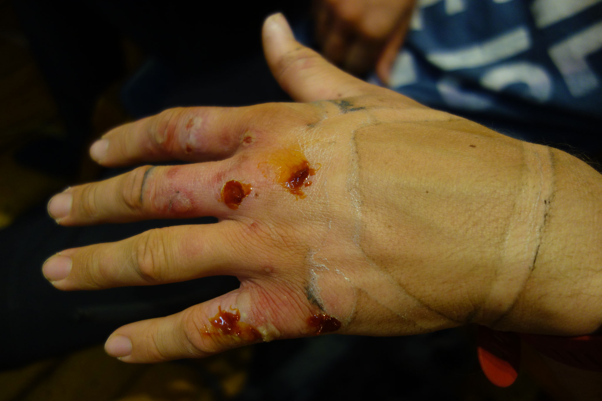
We planned to walk 20-25 km per day with about 20 kg on our backs, which will be our average milage and weight during the crossing. After following Alb valley to Marxzell, the trail led us along the Maisenbach to Rotensol where we camped the first night. However the evening was more of a battle against an army of tiny little ticks which we had to pick off our legs every 10 minutes to avoid becoming a huge big borelie ourselves immediately.
The next day we went on via Dobel to Kaltenbronn. The ‘Hohlohturm’ - a tower reaching up to 1012 m a.s.l. - marked the highest point on our tour. After a less ticky-tacky second night we moved on to Enzklösterle, then towards Zavelstein. The last night was spent on a wonderful moss bed. The last stage then brought us along Calw over beautiful fields and through the forest to Ostelsheim - home of Jens. All in all 100km in four stages, optipfiffi!
Additionally this tour was our first chance to really check out our new 95 liters ‘Capacity 3’ Bachpacks. Its bearing system really allows small adjustments of the pack on the back and the outer bags are even usable and still empty when the inner barrel is fully filled ;-), which is sometimes not the case with lower quality backpacks. These well-designed outer bags even convinced our sceptics that are more into the lean barrel-shaped backpacks. :-D
Once more we tried to get used to our food rations and to find out, what we could improve. One daily ration of 3000 kcal food weighs 700g! Breakfast alone is 200g (1000kcal), 130g of dinner (~500kcal), snacks for the day make up the rest in weight and calories. That sums up to 17,5 kg food only on our scheduled expedition length of 25 days, not including a small surcharge in packaging weight. Below is an overview of all the food we had with us for these 4 days (the 800 g of cheese that were still in the refrigerator while shooting the picture are missing). That amount of food would feed one person for 16 days. In the next step we will try to pimp the whole thing with a little more colour and vitamins!

Concerning the weather: disappointing! No thunderstorms, hardly any clouds, just sun and heat... no chance to test our ponchos at all, just tons of goo all over the place... On this tour the poncho-sceptics should have been convinced, but they will have to saddle their backpacks and start walking on a nice rainy day now! ;-)
Við sjáum!
Förum í svartan skóginn!
#4sam8sam1sam
23th May
Mission Iceland Test Tour - Vogesen

Since we will stress our bodies in Iceland very much, it is essential to prepare properly. This is what we did just around
the corner in a first test tour in France for four days (9th to 13th of May). During this time we hiked across les Vosges from Sainte-Marie-aux-Mines to the Ballon d'Alsace. The route lead us
over peaks and passes, through beautiful forests, past impressive cliffs and slopes and even over a snow field.
Besides the fitness check for our bodies we were additionally able to test some other things on the tour. Concerning the rationing of the food, it was interesting to check whether the portions
are enough for our desires ;) Even though there was plenty of space for more food in all the backpacks, we decided to eat just as much as the respective daily portions (~3000 kcal) would allow
us. We measured everything accurately using a gram scale and distributed the food equally. For sharing the food we had to prove our creativity and our geometric imagination: E.g. how do I split a
Grana Padano cheese - shaped like a hollow cylinder sector (for the math nerds with us) - so that everyone gets an equal share??! One can imagine how this was a lot of fun and incredibly
important for the team feeling. =)


Moreover, we managed to test our equipment like stoves, rain clothing or hiking sticks. As expected, we still found some room
for improvement. Best example are the stoves, which we examined in respect to their fuel consumption. Before and after the tour the weight was measured and so we were able to compare the stoves
directly with each other. The Jetboil (gas) was best as it boiled up to 6,8l of water, followed by the multifuel (petrol) with 5,8l and last the Trangia with 4,4l of boiling water per 100g of
fuel.
As we were hiking up to 13 hours a day, there was plenty of time to talk and discuss. One moment it was a more productive talk, whereas in other moments conversions were more about the dreamy
kind of stuff and even the casual trash talk wasn’t missing. And since we didn’t run out of time, we even discussed the perfect length of body hair ;-). One topic which was more important to us
is our interaction with nature in Iceland and our general footprint during the hike, since the icelandic nature is way more sensitive and vulnerable compared to ours at home. We will talk about
this in upcoming blogs.
All in all a quite successful test tour, even though we didn’t get the full icelandic weather simulation. Storm and rain at 5°C only occurred at our destination: le Ballon d'Alsace. Otherwise the
weather was rather kind with us and If someone wonders, why we haven’t mentioned the Waterlily, don’t worry, we will come back to that in a separate detailed blog post.
Until then!
Förum í auðnina!
#4sam8sam1sam
9th May
The WaterLily has arrived!
Finally we have received our long awaited 'WaterLily' - the turbine that will generate electricity from wind AND water and which the Canadian start-up of the same name kindly provides us with for our crossing. Thank you very much!!! After a long, eager expectation we could finally pick it up at the customs and of course we made a small unpacking video, to show you a little bit more of it besides the well-known pictures from the WaterLily website. Like you will see, our euphoria must have split some of our neural nodes... Nevertheless, have fun watching! ;-) How we discovered this great device, and which other devices were interesting, we will tell you a little more detailed below!
On our search for a suitable wind or water turbine that is portable and small enough to bring it with us on our tour, we came across some interesting devices. Great inventions and good ideas that make the use of wind or water energy possible on a small scale. That’s great because you can actually become a bit more independent, especially on longer expeditions where you are dependent on some electrical equipment (GPS device, satellite phone). And usually you wouldn’t leave the camera at home and with a reliable source of energy, one or another spare battery can be dispensed with.
We would like to briefly introduce the three devices that have most appealed to us.
The first device that got our interest, was the ‘Micro
Wind Turbine’ from the product desighner Nils Ferber. Unfortunately, this relatively small and light wind turbine is still under development, which is why we cannot take it on our
expedition.
The second device was the ‘Enomad Uno’ byEnomad. It is a quite small water turbine
weighing 628g with a generator producing 5W at 4,3km/h water speed. The most attractive part: the Enomad Uno is put in the water including a 5600mAh battery pack which is charged in the water.
Perfect for Tours by boat/kayak. The downside is it cannot be replaced with a more capacious battery pack.
The third device is the ‘WaterLily’. With 1.3kg it is heavier than the other
devices but in terms of flexibility it is unbeatable, since it produces electricity from wind and water. Either wind speeds of 58km/h or water speeds of 5,8km/h produce a maximum of 15W of
electric power. Via a cable with two usb ports it can charge your stuff.
But why again do we want to bring a turbine at all? Why not use solar panels or just bring spare batteries, you wouldn’t need
a 1kg turbine?! Well it is true but since we will go to Iceland - well known for rainy and stormy weather - we didn’t want to be dependent on the sun. Even though there will be long summer days,
that can still be darkened for multiple days by a storm ;-). Additionally there was no portable wind or water alternative to solar panels for a long time. And that’s exactly what motivates us to
bring forward one of those new wind AND water alternatives that can produce electricity - even during night.
For now we are happily awaiting the long weekend to go out and actually test the WaterLily!!
In that spirit just one more thing:
Rafmögnum auðnina! - Electrify the desert!
#rechargewithnature #rafmögnumauðnina #electrifythedesert #4sam8sam1sam
29th April
What is the northernmost point on mainland Iceland?
What really is the northernmost stone, sand beach, rock or spot on the mainland of Iceland?
A super interesting topic we want to talk about in this blog entry and we have already been discussing this specific question several times in the past. What we know for sure is, that we simply do not want to start the tour from one of the northern beaches in Iceland. No! In fact, we want to start crossing the mainland at THE northernmost point and make our way down to the southernmost point on the mainland of Iceland.
When asked about the northernmost mainland point of Iceland, the lighthouse of Hraunhafnartangi most likely will shoot out of an Iceland enthusiast. And as you might know, the lighthouse is not a bad guess, as they usually mark the outermost spots of land. So that it is, we thought, we found the starting point without any problem. But far from it...
When our hiking maps arrived, we took a closer look on them. And see what happened, on closer observation, we discovered another bit of land: Rífstangi. This ‘tongue of land’ (from icelandic tangi) made the impression of being even more north than Hraunhafnartangi. So with the help of online tools and our hiking maps, we started to dig deeper into that topic. And tataaa our calculations showed, that Rífstangi is actually 40 m more north than Hraunhafnartangi. Some quick research about the lighthouse of Hraunhafnartangi revealed, that it actually stood at Rífstangi until 1945, but was then moved to Hraunhafnartangi.

During this research we also learned some interesting facts about the Arctic Circle:
Some of you may have already heard that Iceland is pretty much touching the Arctic Circle in the north. Let’s put it this way, if we'd like to start at the Arctic Circle, we would need to have a small boat, or super strong arm muscles to be able to swim very well. Even at low tide, you can’t touch the Arctic Circle on the big island of Iceland without getting your feet wet. The Arctic Circle is about 2.5 km off the mainland, so if you are a great swimmer, it should not be a problem for you - but we're not joining you for that one ;)
However, there are a few other small islands around Iceland. If you use your geographical sherlock sense, you will find the island of Grímsey, which is actually located exactly on the Arctic Circle. But even there, people will have wet feet soon, when wanting to touch the Arctic Circle, as the inclination of the earth's axis changes over the years. In that way the Arctic Circle moves more and more to the north. Currently 14.5m per year to be precise!
The Arctic Circle seems very important to icelandic people (and for sure to the icelandic tourists;)), as every year they carry the steel sphere, that marks the Arctic Circle on Grímsey, a few meters northwards. Thus, the sphere moves slowly but steadily north into the arctic sea. So better be fast, in around 20 years the Arctic Circle will be gone from the island.
But enough for the northernmost point, let’s have a look on the southern end.
There is the same island phenomena in the south. One small island marks the southernmost point on the mainland, which is the island of Surtsey, created by a volcano eruption in 1963. Well, slowly we should seriously think about taking a boat :D
But luckily for this tour, we are only interested in the southernmost point on the mainland. So here comes the question whether it is : Kötlutangi or Dyrhólaey.
Just like in the north, we took the old set square from school and compared the places. And voila, it turns out Kötlutangi is more south. Well, this went actually much quicker than in the north. But we already build up some expertise in using these tools ;)
Interestingly, in the south the lighthouse also stands at the supposed southernmost point and not in fact at the southernmost point. This is probably due to the fact that massive cliffs and rock pillars appear near Dyrhólaey, which makes the place a perfect spot for a lighthouse. Unfortunately we can't tell another exciting story about the southern Arctic Circle here, as it is a bit too far away.

So finally, it is done. Start and end point are found. It took a while, but we had a lot of fun looking for them. Maybe we will train triathlon after that and come back in 10 years and then take the outermost islands as starting points. But you're welcome to pre-empt us! ;)
See you soon!
Förum í auðnina!
16th April
What does unsupported mean
In our texts we often write about the unsupported crossing of Iceland. But what do we actually mean by unsupported? First it should be mentioned that there is no correct definition of this term and that it can be interpreted in different ways. The most radical interpretation would be, having no support of anything at all. Meaning no clothing, no backpacks and so on. You could say a naked crossing. But this is, of course, not realistic and rational, unfortunately :P. For us the term means that we will carry everything we need for the crossing with us. That will include of course all the equipment, but also all the food and other things we need to be independent during the trip. The only help on our tour will be nature itself. As there is plenty of water and energy available to supply us. This self-dependency is another great challenge for us on one hand, but also an equally great incentive on the other.
As an english speaking outdoor person, you may ask yourself, why we explain this word, however the German language has no word for unsupported. And how unfair would it be to just write a German blog entry! ;)
See you soon!
And Áfram Ísland!
10th April
The origin of Mission Iceland
So how did we come up with the idea of crossing this island on foot?!?
Hm... Very good question...
It must have been about one and a half years ago when two of the four friends went climbing together weekly. In that way, they could best forget the grey library everyday life of studying for uni, what mainly was about blowing scientific theories into one's head. Both were actually studying the energy generation from wind, i.e. the conversion of kinetic energy into electrical energy, and were very enthusiastic about it.
What linked them was not only the climbing and the uni stress, but also the desire to grab the hiking backpack including sleeping mat, tent and sleeping bag, to switch off the mobile phone and to disappear into forests and mountains.
And now they were just studying in the library, but as you might know, this often is the most creative time ;) Simply, you often want to try the theory what you are learning and want to see it in practice.
The idea cannot be to only put all this theory into your head, and then simply forget about it after you having taken the exam. Rather, the theory should be explored in practice. Take the theory and get out into nature and really make a difference! Make a change! Break out of this daily work routine and do something really different! Put technology and adventure together! This is what the two wanted to do!
So they stood at the climbing wall and discussed much more than they were climbing. One could also say a classical pub talk at the climbing wall :P
And then they came up with the idea - Why not just take a wind turbine or a water turbine and walk through Iceland? That must somehow be possible. As there is tons of wind in Iceland anyway.
And Mission Iceland was born. The next evening the other two friends were asked directly and the idea took more and more shape :)
See you soon!
And Áfram Iceland!
26th March
Welcome! Velkominn!
Perfect, that you managed to get this far!
So this is the first blog entry on the Mission Iceland website. From now on this blog will be filled with exciting contents and pictures ;)
Here we want to share our project and regularly give updates on the current planning status
We - the four friends - are super motivated to cross Iceland unsupported. And all this by foot within 30 days with a portable wind and/or hydro power plant! "Hm...to carry food and material for 30 days, that's completely impossible! And even if that is possible, why would you do that?
But that's the challenge of the whole thing. We want to cross Iceland by foot without collecting extra food and supplies on the way. In addition, we want to show that it is very easy to recharge your electronic devices such as mobile phones, cameras or GPS watches with the help of renewable energies. This is how we can use the inexhaustible energy source of nature!
But actually who are these four friends?
This is Wendelin, André, Julian and Jens. Four engineering students from Karlsruhe crazy about the outdoors and convinced of renewable energies. We lived together in the same student residence in Karlsruhe for several years and therefore know each other pretty well. We are always looking for adventures and challenges and have already experienced a lot together. But Mission Iceland is to become our greatest adventure.
We are currently in the process of finding a suitable wind and/or hydro power plant, as this is perfectly suited for electricity production in Iceland. Iceland, especially in the highlands, is full of water and wind, which can serve as an excellent source of energy. In our initial euphoria, we had considered designing this device ourselves, but after a few brief considerations we came to the conclusion that our capabilities and resources were probably not quite sufficient enough to develop such a plant within 6 months ;).
So now it's time to browse the Internet and find cool devices. And we can already promise you, there are some interesting ideas! We are currently in the process of establishing contact and hope to find a cool cooperation soon :) But we are very confident about that!
The rough route can be found at "The Route". Further, we also agreed in doing the trip in August 2018.
That should be enough for the first post. We don't want to overload you with too much text ;)
See you soon!
And Áfram Iceland!